Originally published on Dec, 5, 2019 by Forbes.
By: Jacqueline Legrand
October 2019 was a particularly devastating month for natural disasters. Tornado outbreaks in North Texas were the costliest in state history, while the Tick and Kincade Fires left more than 2 million California residents without power. In Japan, 45 million residents received the highest-level warning alert as Typhoon Hagibis hit Tokyo.
As catastrophic events continue to rise in frequency and impact, speed and efficiency are at a higher premium. There is an immense amount of information that local authorities, corporations and emergency management personnel have to process and communicate internally and externally: population and staff locations, weather events, property exposure, evacuation resources, supply chain disruptions and public safety services, to name a few.
Quickly making sense of all that data and accurately relaying it to others is imperative in preventing significant losses in human life and in associated damage to property, infrastructure and business continuity.
Geospatial information systems (GIS) are analytical, data management and visualization tools that are built so the right information can be rapidly understood. For all phases of emergency management — preparedness, response, mitigation and recovery — GIS technologies can improve how we respond to extreme weather events and manmade hazards.
Here are four ways GIS can help local authorities, corporations and emergency responders.
1. Spatial Awareness
Contextualized information allows us to understand data. Our eyes glaze over while reading a spreadsheet with thousands of cells, but we can quickly grasp a pie chart or a line graph. “Up and to the right means growth” is much easier to comprehend and present to others.
GIS technologies provide spatial awareness to improve response times for local and state governments, support organizations and impacted parties (e.g., utility companies, manufacturers, real estate, retailers). In addition, GIS helps communicate the locations and best routes to emergency evacuation centers, as well as provide critical information on road closures and at-risk zones.
Spatial awareness is also valuable in preparedness and recovery efforts. Visually presenting where certain locations are lacking emergency response resources compared to climate risk can allow policymakers and governmental agencies to identify which areas need the most attention prior to or following a catastrophic event.
2. Real-Time Monitoring
Perfectly predicting the weather is impossible; ask anyone who has left home without an umbrella after listening to their local weather station. But you do know when you’re wet!
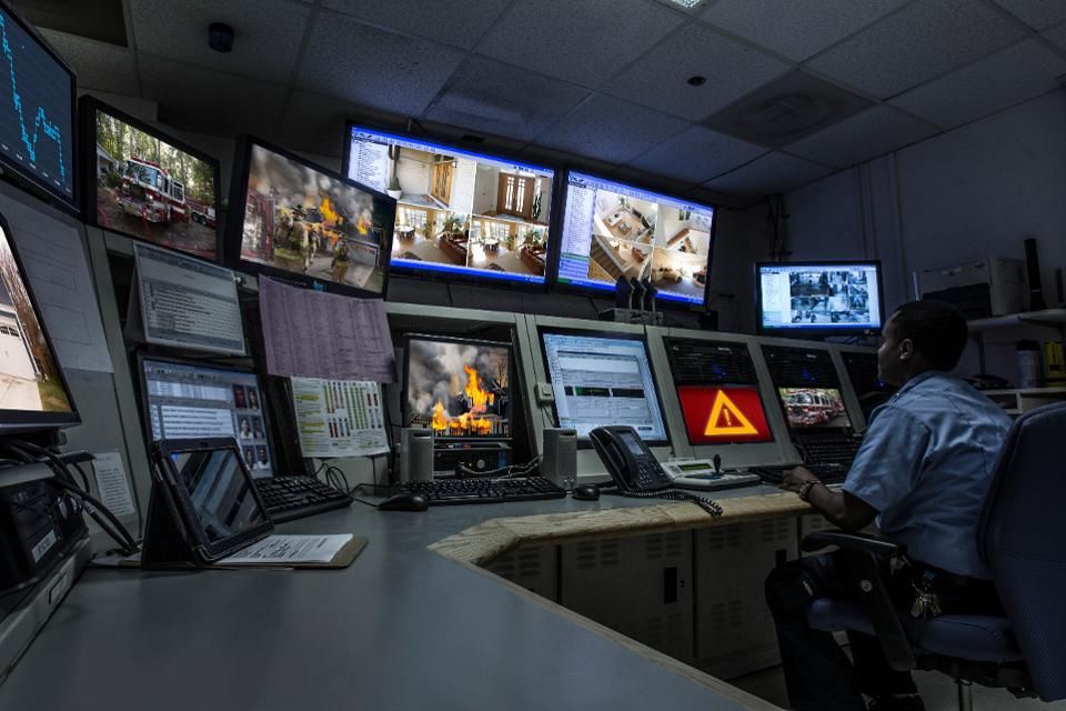
Sudden changes in weather patterns can drastically change emergency response paths and supply chain routes. From wildfires to floods, the safety of first responders, company personnel and community members is dependent upon real-time tracking of wind speed and direction.
GIS integrates data from a variety of sources and formats, including real-time information. As updates come in from the National Weather Service, on-the-ground responders and government agencies, GIS technology immediately analyzes and highlights the highest risk areas.
Leveraging this analysis, emergency management teams can promptly identify and dispatch the nearest units to specific areas, as well as model where more resources may be needed as the situations progress.
3. Integrated Data
Data silos are serious roadblocks for disaster preparedness, response and recovery. Given the number of resources and agencies that are utilized when dealing with a catastrophic event, it is impossible for any single person or organization to jump between data sources as they try to compare one spreadsheet or live report with tens of others.
GIS frameworks centralize and organize data maintained across a wide variety of agencies, organizations and institutions. Especially when coupled with monitoring devices such as drones or remote sensing devices, GIS can project how the data interacts with one another.
Bringing all this data into one geospatial map presents a clearer picture of all the contributing factors to proper short- and long-term preparedness, as well as a swift system to analyze how certain relief efforts may impact other elements of direct response. It can bridge corporate resources — for example, building design plans — with emergency response teams to improve rescue operations and decrease potential damage.
4. Public Education And Awareness
We rely on a wide variety of apps and websites to determine where we eat, shop and relax, as well as how we get from point A to point B. However, these systems are not designed for cases of emergency.
GIS serves as a supportive tool to relay information in a way for the public to easily comprehend and act on ongoing warning or emergency notifications.
Showcasing the scale of damage through geospatial mapping can also improve outreach efforts and drive greater attention to improving future relief efforts. Visually representing what resources are nearby (or what’s not) before, during and after a crisis can convey to others the seriousness of a situation much more clearly than a collection of data grids.
Greater GIS Adoption Is Needed
GIS technologies are not new to emergency management, but widespread adoption has yet to fully take place. Even as governments invest in GIS to support emergency operations, further use and data aggregation can provide massive improvements in addressing future climate risk scenarios.
2019 is looking to continue the trend of record-breaking catastrophic events. It is difficult to imagine that 2020 will see a reversal in the severity and frequency of natural disasters. Therefore, it’s essential for both public and private organizations to make greater investment in and encourage the adoption of GIS to ensure the disasters of the future are less catastrophic.

